State-of-the-Art Equipment Portfolio
We invest in the industry's most advanced surveying technology to deliver unmatched precision and efficiency
High-Precision GPS Systems
Delivers real-time, centimeter-accurate positioning for boundary surveys, site control, and GIS mapping. Ideal for large-scale terrain modeling and establishing project baselines.
Key Features
RTK positioning, multi-constellation support, real-time corrections, centimeter-level accuracy, long-range capabilities.
Applications
Boundary surveys, site control networks, topographic mapping, construction layout, GIS data collection.
LiDAR Drones
Capture detailed aerial topographic data over large or difficult-to-access areas. Generate high-resolution 3D point clouds, Digital Elevation Models (DEMs), and volumetric calculations with speed and accuracy.
Key Features
Aerial LiDAR scanning, high-resolution point clouds, rapid data collection, large area coverage, inaccessible terrain access.
Applications
Large-scale topographic surveys, volumetric calculations, infrastructure inspection, environmental monitoring, disaster assessment.
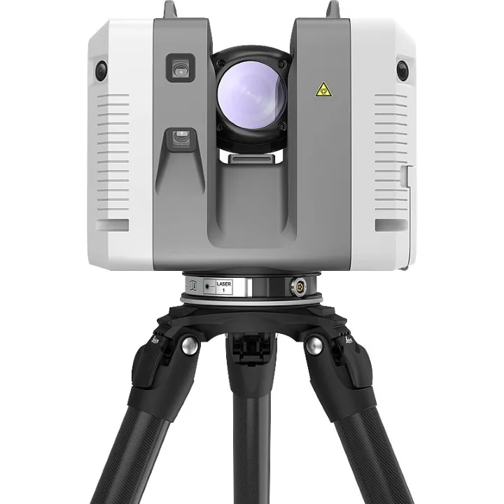
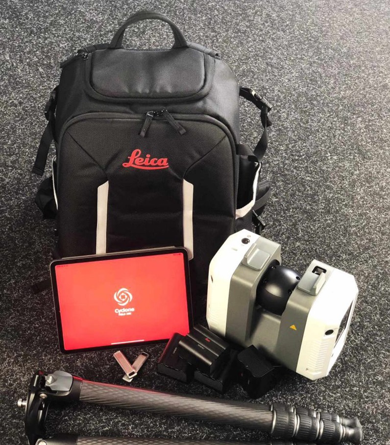
Leica RTC360 3D Laser Scanner
Delivers high-speed, high-resolution 3D scanning for as-built documentation, structural analysis, and clash detection. Captures millions of points per second with color and HDR imaging.
Key Features
High-speed scanning, color and HDR imaging, automatic registration, 360-degree coverage, millimeter accuracy.
Applications
As-built documentation, BIM modeling, structural analysis, renovation planning, clash detection, facility management.
Total Station
Combines electronic distance measurement and angular precision for detailed layout, monitoring, and construction staking. Essential for setting out foundations, columns, and critical building elements.
Key Features
Electronic distance measurement, angular precision, robotic operation, reflectorless measurement, integrated data collection.
Applications
Construction layout, building staking, monitoring surveys, precise measurements, control network establishment.
Automatic & Digital Levels
Ensures precise elevation control and leveling across sites. Used for grading, floor flatness checks, and drainage verification with reliable, repeatable accuracy.
Key Features
Automatic leveling, digital readout, high precision, reliable accuracy, easy operation.
Applications
Elevation control, grading verification, floor flatness testing, drainage design, benchmark establishment.